Banners

Chapel Falls, Ashley, MA. Chapel Brook is a tributary of the South River in the Deerfield River watershed and the name of a 173-acre open space preserve located along the brook. The Chapel Brook reservation, managed by the non-profit conservation organization The Trustees of Reservations, is located in Ashfield and contains Chapel Falls, a series of three waterfalls on Chapel Brook and Pony Mountain (also called Chapel Ledge), a 100-foot open granite cliff face and popular recreational rock climbing site. Photo credit: Jeannette Pierce.

Panther Mountain, Appalachian Mountains. Photo credit: William Adamczak - AMC Photo Contest.

Cheshire Lake, Berkshire County, MA. This lake, also known as Hoosac, Hoosick (primarily in New York) and Hoosuck (mostly archaic) Lake, is a reservoir on
the Hoosic River, which runs seventy miles from its headwaters in Massachusetts to the Hudson River at Stillwater, NY. The different spellings are the result of varying transliterations of the river's original Algonquian name. It can be translated either as "the beyond place" (as in beyond, or east of, the Hudson) or as "the stony place" (perhaps because local soils are so stony). Photo credit: Jeannette Pierce.

Deerfield River, northwestern MA. This heavily-dammed river runs for 76 miles, from southern Vermont through northwestern Massachusetts to the Connecticut River. The river was historically influential in the settlement of western Franklin County, MA, and its namesake town. It is the Connecticut River's second-longest tributary in Massachusetts, just 2.1 miles shorter than Metropolitan Springfield's Westfield River. Photo credit: Jeannette Pierce.
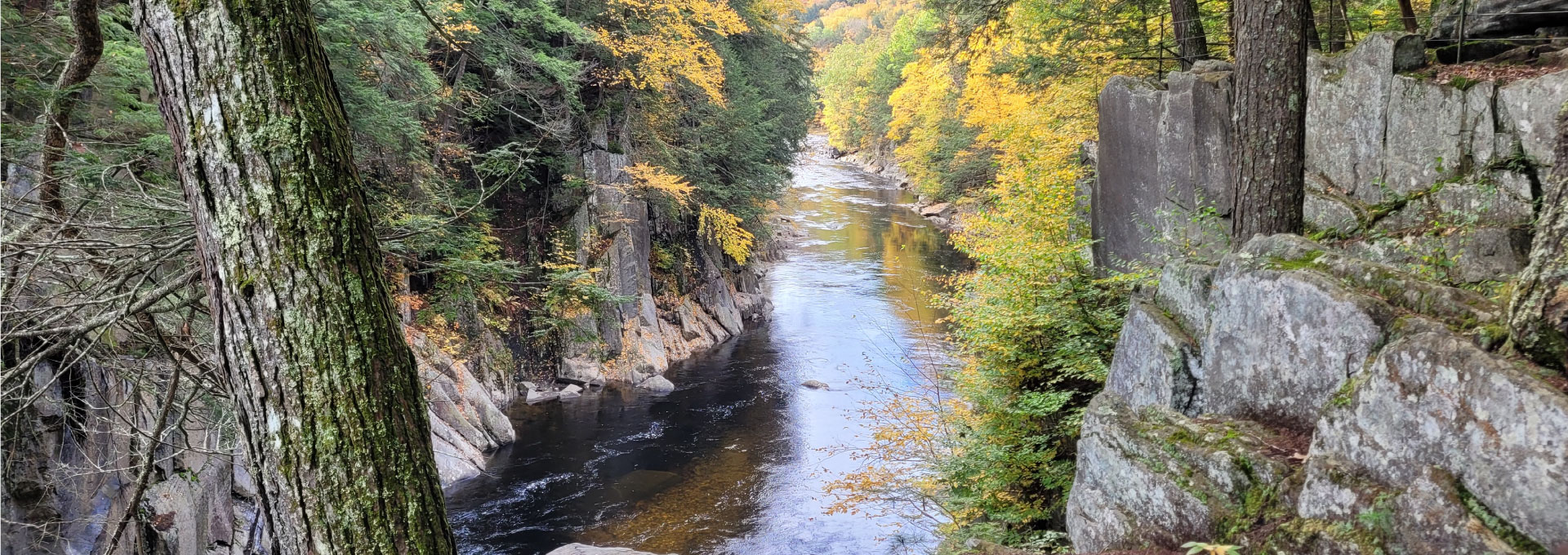
Chesterfield Gorge, Chesterfield, MA. This nature reserve is owned by The Trustees of Reservations, who have administered the property since 1929. Photo credit: Jeannette Pierce.

Chesterfield Gorge is a dramatic rock canyon that forms the entrance to a natural recreation area along the Westfield River. Seventy-foot walls – carved by centuries of rushing water from the East Branch of the Westfield River – rise from a landscape located adjacent to the General Marquis de Lafayette Trail. Across the river, you'll see stone abutments from a historic bridge that was swept away by floodwaters in 1835. Photo credit: Jeannette Pierce.

Cheshire Lake, Berkshire County, MA. This reservoir, also known as the Hoosac Reservoir or Hoosac Lake, is divided into three basins by a pair of causeways. The south basin is extremely shallow, the middle basin has a maximum depth of about six feet, and the north basin has a maximum depth of nine feet. All three basis are choked with submerged aquatic vegetation during the summer months. Photo credit: Jeannette Pierce.

National Scenic Trail. This section of the 215-mile long NET follows the Eyrie House Ruins Trail up to the ruins of the former Eyrie House hotel, and then on to the summit of Mount Nonotuck in the Mount Tom Reservation. The hotel burned to the ground in 1901, but was a popular destination in the late 1800s. Photo credit: Jeannette Pierce.

Nonotuck Park, Easthampton, MA. Enjoy picnics, a ballgame, and some down time at this family-friendly park. If you're up for a light hike, the Toteman trail runs the outskirts of the park, complete with views of Mount Tom and access to Nashawannuck Pond. Photo credit: Jeannette Pierce.

Joseph Allen Skinner State Park. This state-owned, public recreation area is located in the towns of Hadley and South Hadley in the Connecticut River Valley of western Massachusetts. The park surrounds Mount Holyoke, the westernmost peak of the Mount Holyoke Range. At the summit is the historic Prospect House, an old hotel first opened in 1851. Photo credit: Jeannette Pierce.