CONTACT  |   JOIN  |   AMC  |   AMC ADVENTURES   

Hiking Committee

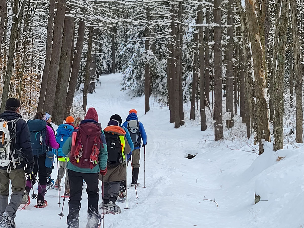
The Hiking (formerly Outings) Committee organizes general, non-technical events such as hiking, cross-country skiing, snowshoeing, and backpacking trips. We have a very long list of hiking trips. Most hikes occur on weekends, but we do have a tradition of Tuesday hiking trips as well. Check out our schedule!

Thanks to the leaders for leading this hike - what beautiful snow-covered scenery and that view of Quabbin was amazing! – Nancy

Thanks to the leaders for leading this hike - what beautiful snow-covered scenery and that view of Quabbin was amazing! – Nancy

Sometimes, in the winter, our "hiking" trips suddenly become "snowshoeing" or "cross-country skiing" trips. Such is life in New England!
We're always looking for trip leaders, especially those with new ideas for trails to hike. If you're interested, please contact our Hiking Chair.

Joining a Hike

Please read the AMC Trip Policy (PDF) before joining a trip.
Be sure to bring lunch and liquids, bug repellant and sunscreen, and clothing and footwear appropriate to the conditions. When car-pooling, please offer a contribution to the driver for fuel costs.
To find out more about a scheduled hike or to sign up, contact the leader, coordinator, or other person listed for that trip.

Upcoming Activities

Click or tap on the Register links to learn more and/or register for activities.

Mt. Greylock Visitor's Center to Rounds Rock Loop

Location: Lanesborough, MA
Date: 19‑Apr‑2025
Register »
Starting from the Visitor's Center, we will climb the Woodeson Spring Trail to the Rounds Rock Trail where we will have lunch at a beautiful view, and return back to the Visitor's Center on the Northrup Trail. We will pass through various forest types and should see lots of wildflowers! Approx. 7 miles.

Robert Frost Series Section 1 on Earth Day

Location: Hadley, MA
Date: 22‑Apr‑2025
Register »
Join us on Earth Day for the inaugural Robert Frost Trail (RFT) Hiking Series. We will be hiking the newest section, # 1, from Skinner State Park to Notch Visitors Center in Mount Holyoke State Park. The RFT route takes hikers over the top of the range not once but twice, taking advantage of lower "saddles" in the ridge. The terrain is varied, with steep ascents and descents and also gentler flat or rolling rambles. Along the way, hikers experience both the northern and southern faces of the range, portions of the famous ridgetop route with stunning views, and the lovely Lithia Springs Reservoir.
This is a moderate to strenuous hike due to elevation changes and rocky terrain. The hike features varied landscapes, including hardwood forests, open ledges, and occasional steep sections that provide a good workout. We'll take breaks to enjoy the views and appreciate the natural beauty that inspired poet Robert Frost, for whom the trail is named. Car spot needed at the Notch Visitors Center.

Adaptive Hiking Training

Location: Russell, MA
Date: 25‑Apr‑2025
Register »
Enjoy the spring weather and learn how to foster safe and welcoming outdoor experiences for people of all ages and abilities! This year, AMC is partnering with All Out Adventures, a Northampton-based organization that promotes community and independence for people with disabilities and their family and friends through outdoor recreation, for a series of adaptive hikes and training opportunities.
The training is open to volunteers who are interested in learning how to assist in an adaptive hiking program for people with disabilities. Topics will include disability etiquette, an overview of adaptive equipment, various techniques, and lots of practice time with the adaptive equipment.
The training will be held at Noble View Outdoor Center, at 635 South Quarter Road, Russell, MA 01070. Please bring lunch.

NH Hikes: North Pack and Pack Monadnock

Location: Peterborough, NH
Date: 26‑Apr‑2025
Register »
Summit North Pack and Pack Monadnock out and back from the north. On a clear day enjoy views from both summits with the opportunity to climb the fire tower on Pack Monadnock during lunch. Overall difficulty is intermediate. Approx. 7.5 miles with 2,150 elevation gain, averaging 2 mph with breaks to enjoy viewpoints.
This route includes steep and moderate terrain with some moderate rock scrambling. The hike may be modified based on weather or trail conditions. Participants will receive an email a few days before the hike confirming the route and meeting place.

Leadership Skills Refresher Course

Date: 27‑Apr‑2025
Register »
This event is for the leaders and leader candidates of the Western MA Mountaineering Committee and is centered around anchor building, rock climbing safety, and curriculum re-education. Contact: chrisneilamc@gmail.com.

[Womens+] Hike to Tannery Falls and Burnett Pond

Location: Savoy, MA
Date: 03‑May‑2025
Register »
Moderate hike of ~6 miles with 500-600 ft elevation gain on the Tannery Trail to Tannery Falls (~70-80 ft waterfall). We'll take a lunch and photo break at the falls then hike back. Option to add an additional 1.8 easy miles to visit Burnett Pond on the other side of the parking area.
Required gear: sturdy hiking shoes or boots, synthetic hiking attire including a warmer layer to carry (no cotton), rain gear if there is a chance of rain, 1.5-2 liters of water, snacks and lunch, personal first aid kit.
Recommended gear: trekking poles, sunblock, hat, bug spray, spare socks. Possible 5/4 rain date depending on group availability.
Affinity activities are designed for a specific audience, but everyone is welcome. If you do not identify with the specified group, we trust that you have reviewed our allyship criteria, have done your due diligence to educate yourself, and have committed to abide by our Code of Conduct. If you have questions, please contact the trip leader(s) by emailing them for more information.

AT Hike Series 2025 Section 1

Location: Mount Washington, MA
Date: 03‑May‑2025
Register »
Section 1. Sages Ravine to Guilder Pond 6.7 miles, Elevation change: 1200 ft., rain date: May 4. Starting on the CT/MA border hike north on the AT to Sages Ravine, a beautiful, mossy gorge with cascading waterfalls and crystal-clear pools, the trail ascends steadily towards the MA border. The ravine is known for its lush forest and refreshing waters, making it a great spot for a break before the climb. From here, the AT climbs Mount Race (2,365 ft), offering spectacular ridgeline views to the west, with sheer cliffs dropping off to the side. This portion of the trail is exposed in places, providing breathtaking panoramas of the Taconic Mountains and the Housatonic Valley. Continuing north, the trail ascends Mount Everett (2,624 ft), the highest peak in the southern Berkshires. The climb is steep but relatively short. The summit, once home to a fire tower, still provides excellent views of the Catskills and the Hudson Valley.
Descending from Everett, the trail enters a pleasant, wooded area before reaching Guilder Pond, a peaceful high-elevation pond surrounded by evergreens. A short side trail leads to a picnic area and a scenic loop around the pond.

Lower West River, Class 2 Whitewater

Location: Jamaica, VT
Date: 04‑May‑2025
Register »
The Army Corp is scheduled to release approximately 1500 cfs of water from the Ball Mt. Dam on this weekend. This trip is going to cover the lower and easier section of this whitewater stretch of river. We will be starting at the lower end of Jamaica State Park and paddle to West Townsend. This section features some large waves and large holes most of which are avoidable with whitewater skills. Cold weather paddling gear such as a wet suit, semi-dry top may be necessary.

Mt. Toby via Sugar Farms Trail

Location: Sunderland, MA
Date: 06‑May‑2025
Register »
The Sugar Farms Trail is largely flat for the first two-plus miles. We then turn on to the Summit Trail which rises quite steeply along a rough, and often muddy, old woods road, arriving at the summit behind the fire tower. If the timing is right, we may see hepatica or other woodland flowers poking through.
There will be an extended break at the tower, giving everyone time to climb the tower and to enjoy a relaxed snack or early lunch. We will return to our cars via Tower Road, the better-known Mt. Toby route.
This hike is rated as vigorous mostly due to the steep 1/2 mile of climbing to get to the summit. Total elevation gain over the six mile loop is 1,062'.

[Womens+] Guided Wildflower Hike in the Southern Berkshires

Location: Sheffield, MA
Date: 10‑May‑2025
Register »
Join us for this Women+ 4 mile, easy, guided Wildflower Hike in the Southern Berkshires. Famed for its displays of spring wildflowers, Bartholomew’s Cobble supports nearly 800 species of plants, including many rare ferns and wildflowers. Trillium, spring beauty, wild ginger, blue cohosh, toothworts, and Dutchman’s breeches are just a few of the amazing diversity of plants we can expect to see.
Please be prepared at the trailhead on the day of the hike for the conditions you will encounter while hiking, such as rocks, exposed roots and mud. It is essential to have proper footwear (sturdy, waterproof hiking boots are recommended), snacks, a lunch and water. (two liters for the average hiker) Rain gear and hiking poles are suggested. Please dress in layers, as it is easier to peel than to bundle if the temperature changes. Avoid cotton if you can, as it does not retain warmth once damp. A hat, sunscreen and bug repellent are recommended.
Affinity activities are designed for a specific audience, but everyone is welcome. If you do not identify with the specified group, we trust that you have reviewed our allyship criteria, have done your due diligence to educate yourself, and have committed to abide by our Code of Conduct. If you have questions, please contact the trip leader(s) by emailing them for more information.

[Women's+ Hike] Sunset/Full Moon Hike to Horse Mountain and White Rocks

Location: Haydenville, MA
Date: 12‑May‑2025
Register »
Hike 2-2.5 miles round trip at a relaxed pace to the White Rocks overlook, break for snacks or packed dinner, and enjoy the sunset and full moon if visible. Terrain is easy-moderate and includes moderate hills.
Needed gear: sturdy hiking shoes or boots, 1 liter of water, a snack or sandwich, headlamp, extra layer for the time we will be sitting still to eat and enjoy the view. Recommended: sunblock and bug spray, something to sit on that is easily carried.
Affinity activities are designed for a specific audience, but everyone is welcome. If you do not identify with the specified group, we trust that you have reviewed our allyship criteria, have done your due diligence to educate yourself, and have committed to abide by our Code of Conduct. If you have questions, please contact the trip leader(s) by emailing them for more information.

[Women's+ Hike] High Ledges Wildlife Sanctuary and Massaemett Mountain

Location: Shelburne, MA
Date: 18‑May‑2025
Register »
Hike is ~6-6.5 miles and includes several overlooks - Beaver Pond and the Shelburne Tower at the summit of Massaemett Mountain. Shelburne Tower features a tall narrow staircase for which headlamps are needed during the day since not all areas get sufficient light from windows. The top offers far views of the northern pioneer valley.
Frequent elevation change/hilly terrain throughout the hike. Mostly moderate with some steeper trails. Trekking poles recommend. Optional after hike visit to nearby Shelburne Coffee.
Affinity activities are designed for a specific audience, but everyone is welcome. If you do not identify with the specified group, we trust that you have reviewed our allyship criteria, have done your due diligence to educate yourself, and have committed to abide by our Code of Conduct. If you have questions, please contact the trip leader(s) by emailing them for more information.

Alander Mountain

Location: Mount Washington, MA
Date: 20‑May‑2025
Register »
We will take the Alander Mtn trail from the Mt Washington State Forest Headquarters in the South Taconics. Let's hope for a clear day; there are great views from the open summit. Bring plenty of water, lunch, and snacks. This moderately paced hike is approximately 6 miles with 1200 feet of gain.

Trail Day WMA: NH Hikes: 52WAV Mount Cube

Location: Wentworth, NH
Date: 07‑Jun‑2025
Register »
Hike to Mount Cube out and back on the Appalachian Trail. On the NH 52 list with a view, the summit offers far views of the surrounding mountains. 7.5 miles on mixed terrain, with some steep sections including rock scrambles and approx. 2,800 elevation gain. Average pace of 2 mph with breaks to enjoy viewpoints.
The hike may be modified based on weather or trail conditions. Participants will receive an email a few days before the hike confirming the route and meeting place.

Mount Monadnock via the Pumpelly Trail

Location: Dublin, NH
Date: 17‑Jun‑2025
Register »
The Pumpelly Trail is the longest trail on Mount Monadnock - a 9 mile round trip with about 1,965 feet of elevation gain. After winding through forest, the trail begins to climb, often steeply over rocks. After rising above treeline, it becomes very exposed all the way to the summit. If we are lucky, we will be able to see all the way to Boston from the top.
Participants must have adequate layers, sturdy footwear, and sufficient water and snacks/lunch. While the ascent will raise our heart rates a bit, the descent is challenging in a different way, testing our quads and knees, and requiring good balance as we clamber down over the rocks. Participants must have good fitness and be reasonably confident negotiating the rocky terrain, both ascending and descending the mountain.

Hike to Upper Goose Pond Cabin

Location: Lee, MA
Date: 28‑Jun‑2025
Register »
Join us for a 4.3 mile round-trip relaxed-pace hike to the cabin (725' elevation gain). The route follows the Appalachian Trail for about 0.5 mile where it crosses the Mass Pike and starts a steep uphill for about a 0.5 mile, and then levels off and descends until it reaches the blue-blazed trail that continues to the cabin. A caretaker will be at the cabin starting in May, and hopefully we can get a guided tour. Will definitely have our lunch outside on the porch or even down at the pond for some gorgeous views and possibly have a dip.
Bring your lunch and/or snacks, sufficient water, hiking poles if you have then and wear appropriate footwear (trail runners/hiking boots).

Activity Schedule

All activities are subject to cancellation due to poor weather conditions. Check activities on outdoors.org for up-to-the-minute additions not yet shown here. Not all activities may be posted yet.
Back to top