CONTACT  |   JOIN  |   AMC  |   AMC ADVENTURES   

Hiking Committee

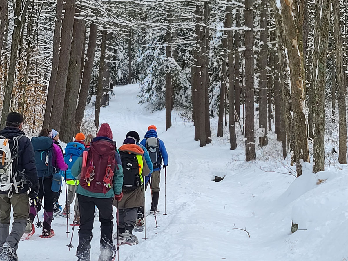
The Hiking (formerly Outings) Committee organizes general, non-technical events such as hiking, cross-country skiing, snowshoeing, and backpacking trips. We have a very long list of hiking trips. Most hikes occur on weekends, but we do have a tradition of Tuesday hiking trips as well. Check out our schedule!

Thanks to the leaders for leading this hike - what beautiful snow-covered scenery and that view of Quabbin was amazing! – Nancy

Thanks to the leaders for leading this hike - what beautiful snow-covered scenery and that view of Quabbin was amazing! – Nancy

Sometimes, in the winter, our "hiking" trips suddenly become "snowshoeing" or "cross-country skiing" trips. Such is life in New England!
We're always looking for trip leaders, especially those with new ideas for trails to hike. If you're interested, please contact our Hiking Chair.

Joining a Hike

Please read the AMC Trip Policy (PDF) before joining a trip.
Be sure to bring lunch and liquids, bug repellant and sunscreen, and clothing and footwear appropriate to the conditions. When car-pooling, please offer a contribution to the driver for fuel costs.
To find out more about a scheduled hike or to sign up, contact the leader, coordinator, or other person listed for that trip.

Upcoming Activities

Click or tap on the Register links to learn more and/or register for activities.

Robert Frost Series #7, Sections 13 & 14

Location: Wendell, MA
Date: 01‑Jul‑2025
Register »
This final stretch of the Robert Frost Trail, Sections 13 & 14, climbs twice, first up Stoddard Hill's open, rocky woodlands - complete with vernal pools and birch groves-then, after a steep ridge scramble and stream crossing, descends to Rt 63. A brief road link brings you to Spaulding Brook Rd, where Section 14 ascends Spaulding Brook's gorge to the dramatic Pigpen Ledges rock amphitheater. North of the ledges, the trail follows a rolling ridge through hemlock and mountain-laurel forests before dropping out to East Chestnut Hill Rd and ending at Wendell State Forest HQ on Wendell Rd. Along the way, enjoy panoramic summit views, rich bird habitat, and a real taste of central New England's rugged backcountry.
Optional post hike: Come help us celebrate completing the RFT!!! Optional social gathering post hike TBD. Stay tuned.

Sunset Hike to South and North Sugarloaf

Location: Deerfield, MA
Date: 02‑Jul‑2025
Register »
Hike 3-3.5 miles to South and North Sugarloaf in South Deerfield. Terrain is overall moderate with hills. Enjoy a packed dinner or snack along with summit views.
Needed gear: sturdy hiking shoes or boots, 1 liter of water, a snack or sandwich, headlamp, extra layer for the time we will be sitting still to eat and enjoy the view. Optional/recommended: sunblock and bug spray, something to sit on that is easily carried.

Tour de Ponds - Backpacking Southern VT

Location: Stratton, VT
Date: 05‑Jul‑2025 ➢ 06‑Jul‑2025
Register »
Join us for a pond-hopping adventure in the Green Mountain National Forest! While the cyclists of the Tour de France begin their race along the roads of Europe, we'll embark on our own "Tour de Ponds". Our two-day backpacking trip will wind through the forest and past three beautiful ponds: Stratton, Bourne, and Branch.
Expect about 4.5 miles of hiking on Day 1 and around 7.5 miles on Day 2, with minor elevation changes. A detailed itinerary will be shared with participants once they are screened and confirmed for the trip.
This activity is designed for active hikers who have solo backpacking experience and are capable of independent backcountry travel, including bringing and making use of your own shelter and cook systems. An equipment list will be provided once you are confirmed for the trip.

MA Appalachian Trail Blotz Road to Dalton (Gulf Road)

Location: Dalton, MA
Date: 05‑Jul‑2025
Register »
This section of the Appalachian Trail blends forested ridgelines with an urban passage through Dalton, MA. The trail begins with a brief climb to the summit of Warner Hill, where hikers are rewarded with sweeping views of the surrounding valleys. From there, it follows a gentle ridgeline, passing through a mix of woodlands before reaching the Kay Wood Shelter. The journey continues over the rolling terrain of Day Mountain before descending toward Dalton. We depart our wilderness setting and walk onto Depot Street and the required stop at Sweet Pea's Ice Cream before continuing through town to our cars on Gulf Road.
Refer to the registration page for the sign-up process, general information, and what to wear.

Mt Tom Hike to the Eyrie Ruins

Location: Easthampton, MA
Date: 08‑Jul‑2025
Register »
We will meet at the Visitors Center at Mt Tom and hike on Section 6 of the NET to Goat Peak with views of Easthampton, then go up the fire tower for a 360-degree view of the Connecticut River Valley and the Holyoke Range. This section is short but fairly steep. From there, we will continue on the NET to Nonotuck Peak with views of the Oxbow on the Connecticut River, then on to view the Eyrie Ruins, the remains of a hotel that was built in 1861 and burned down in 1901. We will then head back to the parking lot on the McCool Trail.
The total distance will be 3.5-4 miles. Please bring snacks or lunch and plenty of water. Wear sturdy shoes and dress for the weather. Dress in layers and avoid cotton if you can, as it does not retain warmth once it is wet. Hiking poles, bug repellent, sunscreen and a hat are recommended.

Examine the Local Effects of Climate Change

Location: Petersburgh, NY
Date: 12‑Jul‑2025
Register »
Climate change has a global impact, as well as affecting many local areas. We will explore with a guest presenter from Williamstown Rural Lands. We'll hike three miles along the Taconic Crest & Shepherd's Well Trails while we learn how the local climate has shifted through the history of Williamstown, MA. From views across Mt Greylock and along the Taconics, we see evidence of wildly different past climates. At the weather station, we will observe how scientists monitor climate change today.
This out-and-back hike features one steep uphill section and one steep downhill section, but is mainly characterized by rolling terrain. Dress for the expected weather and wear sturdy boots. Bring poles if you prefer, as well as bug repellent, a snack, and water. We will hike with a guest presenter at a slow pace, allowing for discussion and questions.

A.T. Hike Series 2025 Section 11

Location: Cheshire, MA
Date: 12‑Jul‑2025
Register »
Section 11 of the A.T. series offers a mix of forested climbs, scenic ridgelines, excellent wildflower viewing at Gore Pond, and a small amount of walking back into town. Starting from Gulf Road in Dalton, the trail passes by Crystal Mountain Campground before ascending North Mountain, a moderate, steady climb that rewards hikers with forested views. The trail then winds through The Cobbles, a geologic formation offering stunning panoramas of the Hoosiers River Valley. Descending into the town of Cheshire, the trail follows a mix of roads, including Furnace Hill Road, East Main Street, and Main Street, before reaching Railroad Street, the location of the Ashuwillticook Rail Trail.
Refer to the registration page for the sign-up process, general information, and what to wear.

Mass Audubon Pleasant Valley Wildlife Sanctuary

Location: Lenox, MA
Date: 15‑Jul‑2025
Register »
Set amidst more than 1,000 lush acres in the Berkshires, the Pleasant Valley's varied trails wind through forests, meadows, and wetlands. Our hike will ascend the Trail of the Ledges which is a steep 800' climb of 1.4 miles to the summit of Lenox Mt. We will continue on the Yokun Ridge to Yokun Seat with views of Mt Greylock, where we will have lunch enjoying the scenery. We return to Lenox Mt and pick up the less steep Overbrook Trail down the mountain, connecting to Laurel Trail and eventually to the Hermit Thrush Loop. We join up with the Yokun Trail where you will see evidence of the sanctuary's wildlife resident, the beaver, via dams, dens, or lodges and then take the Bluebird Trail back to the beginning.
Hike is approximately 6 miles with 1100' elevation gain. If you are a member of Mass Audubon, you can park for free. Otherwise, there is a fee of $3/seniors or $5/adults.

A.T. Hike Series 2025 Section 12

Location: Cheshire, MA
Date: 19‑Jul‑2025
Register »
Cheshire Ashuwillticook Rail Trail to Greylock summit 8.5 miles, elevation change 2500 feet, rain date: July 20. The ascent winds through dense hardwood forests, offering occasional overlooks as it gains elevation. At the top, the Mt Greylock summit rewards hikers with breathtaking panoramic views stretching across multiple states. The summit features the Veterans War Memorial Tower, a historic landmark, and a lodge offering seasonal amenities. This challenging yet rewarding hike is a highlight of the Massachusetts section of the Appalachian Trail.
Refer to the registration page for the sign-up process, general information, and what to wear.

Bennington Trailfest

Location: Bennington, VT
Date: 26‑Jul‑2025
Register »
Join me at this free event for hikers and the community! Free food and entertainment, info tables, used gear swap, "trail of fortune" prize giveaway, and more. Learn about the amazing hiking resources in southern VT and northern MA, learn tips and tricks from thru-hikers and community members, and more. Stop by the Appalachian Mountain Club - Western Massachusetts table to learn more about our activities!
This event is rain or shine. The rain location will be at the Second Congregational Church, 115 Hillside Street, Bennington, VT 05201.

A.T. Hike Series 2025 Section 13

Location: North Adams, MA
Date: 26‑Jul‑2025
Register »
Summit of Mt Greylock to Rte 2/State Rd, North Adams 6.3 miles, elevation change 2800 ft. Rain date is Sunday July 27. This section of trail features a long, steady descent from the summit of Mt Greylock (3,491 ft) to the valley below. The trail first descends toward Mt Williams, offering occasional viewpoints, continuing past the Wilbur Clearing Shelter, then on to Mt. Prospect, another scenic ridge along the route. The trail descends steeply past the Mt Williams Reservoir. As the trail nears North Adams, it transitions from the forested ridges to more developed terrain, following Phelps Avenue to Rte 2 (State Rd), where an A.T. trail parking area is available.
Refer to the registration page for the sign-up process, general information, and what to wear.

NH Hikes: North Pack and Pack Monadnock

Location: Peterborough, NH
Date: 06‑Sep‑2025
Register »
Summit North Pack and Pack Monadnock out and back from the north. On a clear day enjoy views from both summits with the opportunity to climb the fire tower on Pack Monadnock during lunch. Distance is approx. 7.5 miles with 2,150 elevation gain. We will take breaks for viewpoints, interesting flowers, wildlife and photos.
Difficulty is moderate-vigorous: moderate - intermediate distance and pace on mixed terrain including moderate and steep sections with occasional scrambling. Hikers should be accustomed to significant elevation gain and have hiking shoes or boots with good traction. The hike may be modified based on weather or trail conditions. Participants will receive an email a few days before the hike confirming the route and meeting place.

NH Hikes: 52WAV Mount Cube

Location: Wentworth, NH
Date: 13‑Sep‑2025
Register »
Hike to Mount Cube on the Appalachian Trail. 7.5 miles on mixed terrain, with some steep sections, including rock scrambles and approx. 2,800 elevation gain. Moderate pace with breaks to enjoy viewpoints. On the NH 52 with a view list, the summit offers far views of the surrounding mountains.
The hike may be modified based on weather or trail conditions. Participants will receive an email a few days before the hike confirming the route and meeting place. Possible Sun., 9/14 rain date depending on group availability.

Activity Schedule

All activities are subject to cancellation due to poor weather conditions. Check activities on outdoors.org for up-to-the-minute additions not yet shown here. Not all activities may be posted yet.
Back to top